- Plants
- ›Vascular Plants
- ›flowering plants
- ›monocots
- ›Agaves, Orchids, Irises, and Allies
- ›Orchids
- ›Orchidoid Orchids
- ›Diurideae
- ›Caladeniinae
- ›Caladenia
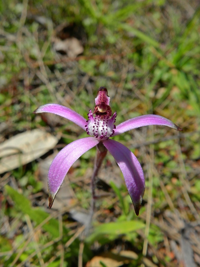
sugar candy orchid
Caladenia hirta
Caladenia hirta, commonly known as sugar candy orchid, flowering plant in the orchid family Orchidaceae and endemic to the south-west of Western Australia. It is a ground orchid with a single broad, hairy leaf and up to six white or pink and white flowers with pink markings.
From the article Caladenia hirta on Wikipedia (CC BY-SA), quoted section by section
Description
Caladenia hirta is a terrestrial, perennial, deciduous, sympodial herb with a single, erect or ground-hugging, broadly linear leaf 40–200 mm (1.6–7.9 in) long and 5–20 mm (0.20–0.79 in) wide. The plant is 10–60 mm (0.39–2.36 in) high with up to six white or pink and white flowers 40–200 mm (1.6–7.9 in) long and 30–50 mm (1.2–2.0 in) wide. The dorsal sepal is erect and curves forward, 15–35 mm (0.59–1.38 in) long and 2.5–3.5 mm (0.098–0.138 in) wide, the lateral sepals 15–37 mm (0.59–1.46 in) long and 3–7 mm (0.12–0.28 in) wide, and the petals 10–35 mm (0.39–1.38 in) long and 2–4 mm (0.079–0.157 in) wide. The labellum is white, 10–20 mm (0.39–0.79 in) long and 5–8 mm (0.20–0.31 in) wide with 4 rows of pink calli along its centre. Flowering time depends on subspecies.
Range & habitat
Candy orchid is a common subspecies of C. hirta and grows in Banksia, tuart and peppermint woodland between Arrowsmith and Albany in the Avon Wheatbelt, Esperance Plains, Geraldton Sandplains, Jarrah Forest, Swan Coastal Plain and Warren bioregions of south-west Western Australia. Pink candy orchid is also common and widespread, often growing on granite outcrops, on the edges of salt lakes, and other moist areas, between Kalbarri and Israelite Bay in the Avon Wheatbelt, Coolgardie, Esperance Plains, Geraldton Sandplains, Jarrah Forest, Mallee, Murchison, Swan Coastal Plain, Warren and Yalgoo bioregions.
Wikipedia: “Distribution and habitat”
Where it lives
Recorded sightings
—
geo-referenced records in GBIF, from museums, herbaria and field observers.
Drag the globe to turn it. Dots are where records exist, not a range map; darker means more records.
In the stacks
Searching the stacks…
Every page naming Caladenia hirta in the Biodiversity Heritage Library →
This page is assembled live from iNaturalist, GBIF, Wikipedia, the Source Library and the Internet Archive. It is not yet part of the hand-edited codex. iNaturalist taxon 787742.